We wanted our own local weather data because no accurate data for our local area is available. The conditions on our property can vary greatly from the nearest detailed dataset for the nearest city. Our goal is to assess the suitability for various fruit species, for a wind turbine, and to maintain soil and plant moisture levels as efficiently as possible.
The weather station collects data every 10 seconds and records averages over 30 minute increments.
A solar panel powers a wireless transmission of the data over a 400 ft. distance to a receiver connected to a laptop. All the data is automatically entered into a database from which important agricultural data can be calculated (eg. chill hours = the annual number of hours below 40F, a critical measure for fruits such as peaches).
At the top of the mounting pole, wind speed is measured by an anemometer (the spinning cups and directional fin). It captures average speeds, gusts and prevailing direction.
Below is a rain gauge (black) which houses a tilting collector that measures 0.01 inch increments of rainfall and allows a rain rate per hour to be measured (a brief storm on May 8 produced a 6 inches/hour rate for 5 minutes).
Below that is the radiation shield (white) which houses the temperature and humidity sensors.
The system provides for an additional 7 sets of sensors to be added in different locations on our property as desired, including soil and leaf moisture sensors.
 |
| The station is mounted on a aluminum pole in an open area near a gate to one of the pastures. |
 |
| The anemometer (the spinning cups and directional fin) is at the top left. |
 |
| The black upside down bucket is the section that collects rain. |
 |
| The white box on the side is the solar panel. |
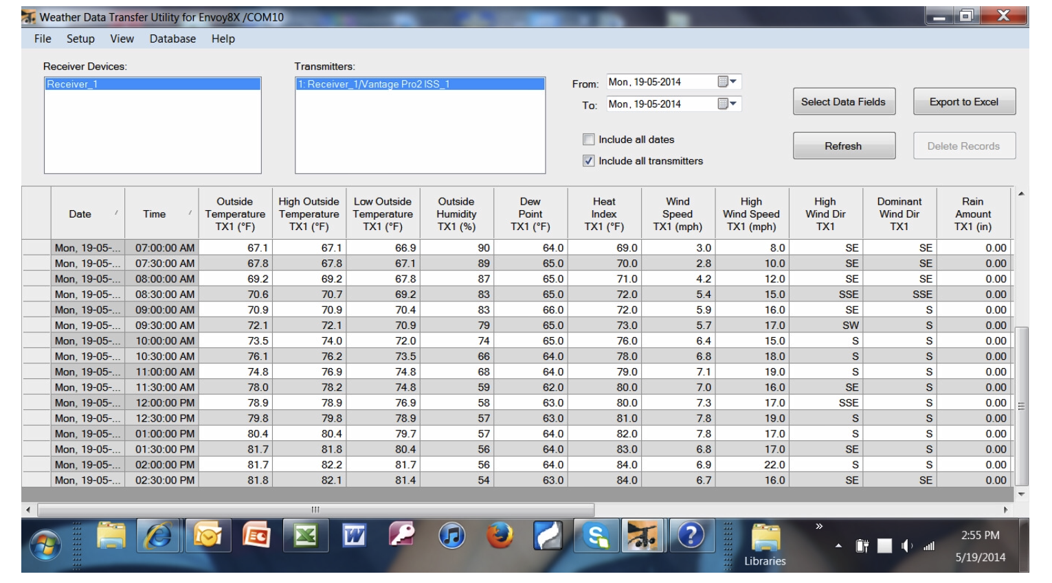 |
| Here is a screen shot of the data we receive. |
 |
| This is the current reading. |
 |
| The data is organized automatically into monthly readings. |
No comments:
Post a Comment